Command, watch, detect
One dashboard covers the full operating loop - built for survey, inspection and security teams that fly more than one aircraft.
Live fleet map
Every aircraft on one map with heading, altitude, speed and battery, refreshed five times per second over WebSocket.
Click-to-plan missions
Drop waypoints straight onto the map and launch. No mission files, no desktop software, no training day.
AI object detection
A YOLOv8 neural network scans the camera feed and boxes people and vehicles live, with running counts per class.
In-flight control
Hold, resume or recall any aircraft mid-mission with one click - commands take effect in under a second.
Failsafe by default
Aircraft return home and land on their own at 25% battery, whether or not an operator is watching.
Hardware-ready
Ships with a built-in flight simulator for demos and training; the MAVLink connector points the same UI at real PX4 aircraft.
Flight logs & PDF reports
Every flight is recorded automatically - route, telemetry, AI detections - and turns into a clean PDF report with one click.
Geofencing
Draw no-fly zones on the map. Missions into a zone are rejected, and an aircraft that strays inside returns home on its own.
Live alert feed
When the AI spots something new - a person, a vehicle - an alert lands in the feed with a timestamp, as it happens.
Area missions
Draw an area on the map and the whole fleet splits it into parallel coverage routes automatically - intent, not waypoints.
Live share view
One click copies a read-only link: crisis staff or stakeholders watch everything live on any phone, and can command nothing.
Airspace awareness
Surrounding traffic on the same map - ADS-B aircraft, Remote ID drones, unknown intruders - with conflict warnings and a UTM check-in step on every launch.
When it matters most
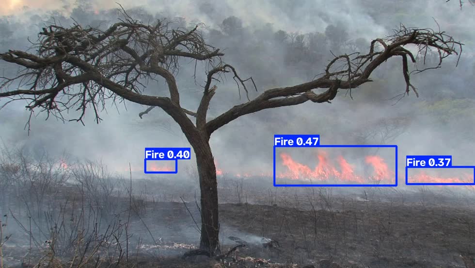
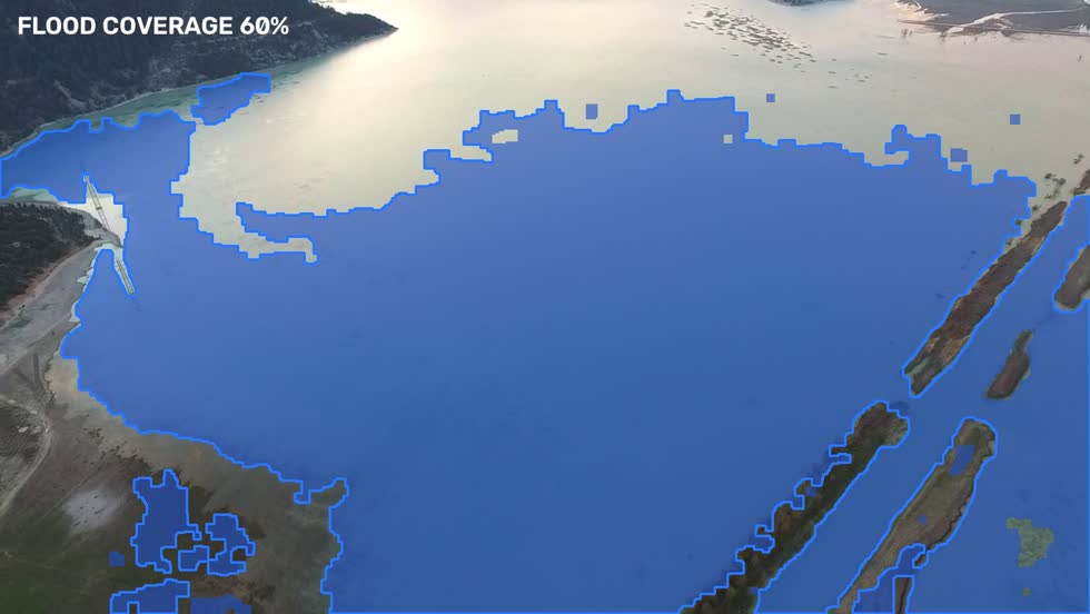
All three modes are live in the platform today - switch between them in the dashboard's camera panel. The images below are real output from our detection pipeline, not mockups, and every sortie ends with a bilingual Situation Report PDF: detection timeline with GPS coordinates, route map, and an SHA-256 evidence hash.
Wildfire watch
A fire-trained neural network spots flames and smoke from the air and places them on the map while the front is still small.
Flood mapping
Computer vision outlines flooded terrain and measures coverage, pass after pass - live situational awareness for crisis staff.
Search & rescue
Drones split a search area into an automatic grid and the AI flags every human shape for the operator to confirm.
A mission in four legs
Plan
Select an aircraft, click waypoints on the map, press Launch.
Fly
The aircraft climbs to cruise altitude and flies the route leg by leg while telemetry streams back.
Detect
The AI watches the camera and counts what it sees - people, vehicles, equipment - in real time.
Return
Mission complete or battery low, the aircraft comes home and lands itself.
What the operator sees
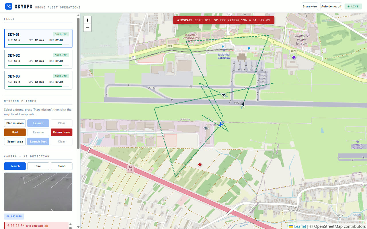
Fleet
Camera - AI detection
Detections update every second, drawn as bounding boxes on the live video - and each new object raises a timestamped alert.
Under the hood
| Telemetry link | WebSocket, 5 Hz per aircraft, auto-reconnect |
|---|---|
| Video / AI | MJPEG stream at 15 fps, YOLOv8 inference on every frame |
| Backend | Python, FastAPI - deploys on any Linux box or cloud VM |
| Frontend | Browser-based, no install; works on any laptop or tablet |
| Flight records | Automatic per-flight logs; one-click PDF reports with route, telemetry and AI detections |
| Safety | Polygon no-fly zones enforced at planning and in flight; automatic return-to-home at low battery |
| Aircraft link | Built-in simulator today; MAVLink / MAVSDK connector for PX4 and ArduPilot aircraft |
Carpathian Drone Summit 2026
See SkyOps flying live - plan a mission yourself and watch the AI pick out objects in the feed. Find us in the EXPO zone.